Earth & space
Weather fronts
Earth science · Meteorology
 Open the interactive 3D model →
Why does a day of drizzle sometimes end with a sudden thunderstorm and then cold, clear air?
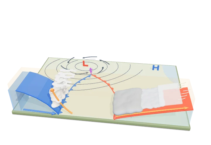
Weather often changes when two big bodies of air meet — one warm and damp, one cold and dry. The boundary between them is called a front. Because cold air is heavier, it always slides underneath the warm air, pushing it upward to make clouds and rain.
A front is the sloping boundary zone between air masses of different temperature and humidity, and mid-latitude low-pressure systems organise these contrasts into a cold front, a warm front and eventually an occluded front. Because cold air is denser it always lies beneath warm air, so warm air is lifted along every frontal surface — steeply at a cold front, producing cumulonimbus and showers, and gently at a warm front, producing widespread layered cloud and steady rain.
Key facts
- Cold-front slope
- ≈ 1:50 to 1:100
- Warm-front slope
- ≈ 1:150 to 1:300
- Typical cold-front speed
- ≈ 25–40 km/h
- Typical warm-front speed
- ≈ 15–25 km/h
- Warm-front cloud shield
- up to ≈ 1000 km ahead of the surface front
- Temperature drop at a sharp cold front
- often 5–15 °C within an hour
Parts you can explore (11)
- Surface weather map
- Low-pressure centre
- Warm air mass
- Cold air mass
- Cool air mass
- Cold front
- Warm front
- Occluded front
- Cumulonimbus clouds
- Stratiform clouds
- Precipitation
In the 3D model
Rotate and take apart the model, follow a guided tour of what each part does and why it’s needed, change it with a live slider, and test yourself with a short quiz. Free, no sign-up.
OpenArc Models’ models are simplified teaching schematics. Terms · Privacy